pwdrskier wrote:How the hell do they not know how high their mountain is. If you go to the true peak or highest point there will be a marker that is a copper disk nailed to a rock this will tell you the height. I forgot what they are called but It was measured by the Parks department I believe.
P.S. I also hike so we use these all the time to see elevation since I don't have a GPS.
USGS markers, United States Geoogical Survey markers.
On a USGS topographic map the datum information is in the fine print at the bottom left of the map. The datum will always be NAD 27. There may be information on how many meters to shift a position to convert it to NAD 83.
THE BEAST doesn't need anyone's help to measure its size.
"Abandon hope all ye who enter here"
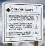
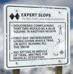
Killington Zone
You can checkout any time you like,
but you can never leave
"The test of a first-rate intelligence is the ability to hold two opposed ideas in mind at the same time and still retain the ability to function" =
F. Scott Fitzgerald
"There's nothing more frightening than ignorance in action" - Johann Wolfgang von Goethe
Ski_the_Moguls wrote:The weather sites say 4235. The magazine says 4241. Sorry Junior, but this goes far beyond just you and Atomic1!
It's POWDR's fault. When Pres. Smith was here, the sources were all in agreement.
Jeez all this hubbub over the difference.
The weather site uses the elevation of where the instruments sit on their tower on the peak. The actual height is 4241 where the aforementioned tag (actually a spike) placed by the USGS, who is responsible for doing so, is located.
c1.8k out
I never met a bottle of Patron I did not like except for an empty one with no backup.
Ski_the_Moguls wrote:The weather sites say 4235. The magazine says 4241. Sorry Junior, but this goes far beyond just you and Atomic1!
It's POWDR's fault. When Pres. Smith was here, the sources were all in agreement.
Jeez all this hubbub over the difference.
The weather site uses the elevation of where the instruments sit on their tower on the peak. The actual height is 4241 where the aforementioned tag (actually a spike) placed by the USGS, who is responsible for doing so, is located.
c1.8k out
We want pictures damn it!
So far I have found no site that confirms the 4241. A Peaks site states the 4235 height, but it is from the 90's and things do change. Oh OH, maybe it is because the sea levels are rising. No, that can't be it because they apparently have only risen about .05 mm in the past quarter century or something like that. FIND THE MARKER!
The USGS marker is not definitive in the absolute since its accuracy is limited to what was available back when it was placed. (Optical instruments) That's what all this datum talk is about. Most folks just go with what has been the historical number. Chances are Mt Washington, Pikes Peak, and Rainier probably are slightly inaccurate as well.
The USGS marker is not definitive in the absolute since its accuracy is limited to what was available back when it was placed. (Optical instruments) That's what all this datum talk is about. Most folks just go with what has been the historical number. Chances are Mt Washington, Pikes Peak, and Rainier probably are slightly inaccurate as well.
AKA Theodel Lights and Mirrors. If it was good enough to put a Minuteman Missile within 4 feet of a target in the 70's after a 6000 Mile flight, it should be good enough to tell us what the altitude is on a Peak, damn it!
Dr. NO wrote: AKA Theodel Lights and Mirrors. If it was good enough to put a Minuteman Missile within 4 feet of a target in the 70's after a 6000 Mile flight, it should be good enough to tell us what the altitude is on a Peak, damn it!
Now there's something to do in the Spring. Hike up, find a USGS marker, and see what the date on it is. I'll bet it's WAY older than 1970.